
The application is an on-demand urban flooding alert workflow using combined information from global and regional weather forecasts and near real time observations including satellites through detection and triggering. Using a tailored urban drainage aware precipitation forecasts, a probability based flood warning can be issued .
Extreme weather in urban environment
This application develops an innovative, on-demand urban flash flood warning system that combines Earth Observation data from novel satellites on clouds information with high-resolution ensemble weather forecasts. By detecting lightning and convective events in real time, the system triggers a tailored post-processing workflow to generate probabilistic, drainage-aware flood warnings and impact scenarios. High-resolution 3D terrain models derived from LiDAR data support the accurate mapping of flood extent and depth.
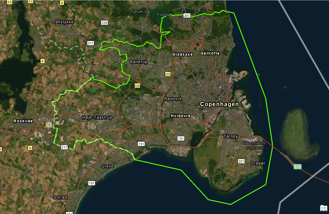
Demonstrated in Denmark (see map of larger Copenhagen, Denmark below) and Italy, it supports timely, location-specific decision-making to better protect cities from extreme rainfall events.
- Objectives
• Develop a real-time urban flash flood warning system using EO and weather forecast data
• Integrate lightning and convective event detection to trigger flood alerts
• Generate probabilistic, drainage-aware flood impact scenarios
• Support urban resilience planning with high-resolution terrain modeling
• Demonstrate the system in diverse European urban environments
- CLEAR-EO partners involved
• Danish Meteorological Institute (DMI) – contributes expertise in weather forecasting, postprocessing, and hydrological modeling to support real-time flood alert generation
• Ithaca S.r.l. – provides advanced capabilities in satellite data processing, 3D modeling, and experience with Copernicus Emergency Mapping Services flood products
• Politecnico di Torino – specializes in high-resolution 3D LiDAR data processing, particularly in complex urban environments, enabling accurate flood impact simulations
- Stakeholders
• Local authorities and municipalities, as well as urban infrastructure planners and managers, interested in flood risk management and preparedness tools
• Meteorological servicesfor forecast provision and alert dissemination
• Citizens and communities, as end-users of flood alerts and emergency response
• European research and innovation bodies, institutions and initiatives focused on climate resilience and EO applications that are interested in evaluating and potentially incorporating CLEAR-EO results into their tools, platforms, or downstream services
- Data sets
• Meteosat Third Generation lightning and water vapor data – real-time convective event tracking for cloud and atmosphere monitoring;
• ECMWF operational ensemble (IFSENS) and DMI operational ensemble (DINI) forecasts –tailored for heavy rainfall probabilities and alert level in in urban areas;
• LiDAR point cloud data – 3D terrain models for mapping of flood extent and depth;
• Sewer system data – Danish planning authority dataset for drainage aware flooding warnings.